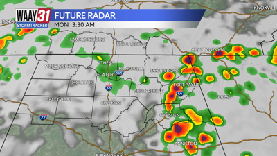
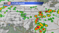

Storms later on tonight can bring some gusty winds, small hail, and localized flooding, but will be out of our hair by sunrise. Rain comes back to the Tennessee Valley tomorrow afternoon, but likely just scattered showers.

Rain and storms continue going into tonight and Monday, some storms may bring some gusty winds and small hail, as well as chance for some localized flooding. More quiet conditions come back on Wednesday.
Showers are starting to build in to the Tennessee Valley, and will continue as we go throughout the evening hours tonight. The heaviest rainfall and worse of the storms are expected to be during the overnight hours, and then ending by sunrise. Overnight lows will be mid 60s.
Showers likely to come back around by the early lunch time hours Monday, and will last until the evening, high temperatures will be in the mid 70s.
Some showers will linger on Tuesday, likely just scattered pop showers starting in the early afternoon, but as of right now, there is not a threat for severe weather with these storms.
Drying trend starts by mid week, as well as warmer temperatures in the mid 80s before our next chance of rain coming back for the weekend.
TONIGHT: Showers and storms late. Lows in the mid 60s. Wind: E 10 mph, gusting up to 20 mph.
MONDAY: Mostly cloudy with afternoon rain, highs in the mid 70s. Wind: SE 10 mph.