

Calm weather will last through the end of the week. This weekend brings a change with 2 storm systems passing through. Rain is expected Saturday and we'll have watch late on Sunday for the possibility of some strong storms.
Tonight brings mostly clear and chilly conditions again. We'll see overnight lows in the mid 40s.
More sunshine is ahead Wednesday. We'll be slightly cooler, but still warmer than average for this time of year with highs in the mid 70s.
Temperatures will bounce back to the upper 70s Thursday and Friday. Some clouds will start moving back in, but the forecast will remain dry.
Rain chances will come back in on Saturday with the most widespread wet weather expected later in the afternoon and evening. The clouds and rain will bring temperatures back down into the upper 60s.
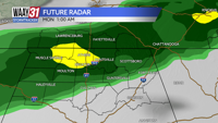
Much of Sunday may turn out dry as we await a line of storms that will push in sometime during the evening hours. Severe weather is possible, but impacts are uncertain at this time. Temperatures will warm back into the mid to upper 70s ahead of any rain.
After a brief break early in next week, more unsettled weather looks possible by midweek.
TONIGHT: Mostly clear skies. Lows in the mid-40s. Wind: Light N.
WEDNESDAY: Mostly sunny and mild. Highs in the mid 70s. Wind: NW 6-12 mph