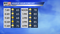


Thursday is the warmest and sunshine-iest day of the workweek! High temperatures will rise to the mid-80s and we'll keep mostly cloud free skies all day.

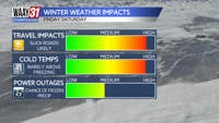
A level 1/5 risk for severe weather returns to North Alabama tomorrow. The greatest threat is gusty wind, the tornado threat is never zero, but it is especially low with this particular system. Thursday also brings a major change on the temperature front as high temperatures will reach only to the mid-70s tomorrow.

Saturday will keep some isolated rain in the forecast through late afternoon but we will be dry by dinnertime. Sunday is another day full of lovely sunshine and calm conditions. High temperatures this weekend will sit in the low and mid-80s, respectively.
THURSDAY: Beautiful sunshine! Highs in the mid -80s. Wind: WNW 5-10 mph.
TONIGHT: Isolated rain starting in the wee hours. Lows in the mid-60s. Wind: ESE 5 mph.